Maps of the Park
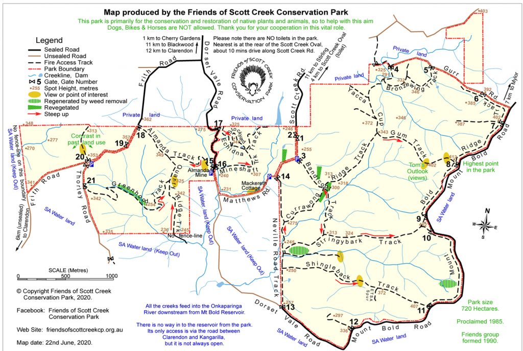
Scott Creek Conservation Park is in the Mount Lofty Ranges near the hamlets of Cherry Gardens, Scott Creek and Bradbury. South-east of the Park is the Mount Bold Reservoir.
The next map showcases some of the key areas where the Friends group has done work over thirty years. You can download a PDF version here.
We also have for sale highly-detailed full contour maps, double sided, in A3 (1:10,000 scale) or A4 (1:15,000) sizes.

Seasonal Closure of Greenhood Track (Gate 18 and Gate 21)!
Phytophthora is present in the area along Greenhood Track. This track will therefore remain closed from 1 April to 31 October to reduce its spread!
For more information refer to Walking Trails or NPWS SA website (Scott Creek Conservation Park – Pests and diseases).


